


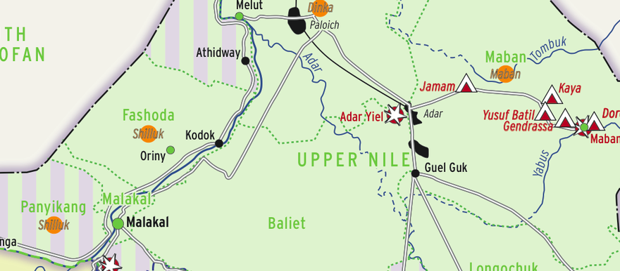
A new map shows areas of control in South Sudan’s Upper Nile state by the SPLA-IO and the SPLA-Juba forces.
The map, created by the Switzerland-based Small Arms Survey and linked for download below, shows that SPLA-Juba forces allied with Salva Kiir control Fashoda, Malakal, Baliet, Melut, Renk, Maban, and Longochuk counties. The other counties of Panyikang, Nasser, Maiwut, Ulang, Panyikang, and Monyo remain contested.
In a report accompanying the map, the Smalls Arms Survey explains that the SPLA-Juba “retains control of Malakal, the Upper Nile state capital, and much of the centre and west of the state,” while the SPLA-IO’s main base of operations is around Wadakona, in a Shilluk part of Manyo county on the west back of the Nile.
The map shows that clashes have taken place in Upper Nile in recent months around Bunj and Adar Yiel in Maban county, Nasser town, the Doleib Hills south of Malakal, and around Renk in the north of the state.
“The GRSS retains control of Nasir, but the SPLA-IO controls much of the countryside around it,” the report continues.
“As of 28 September the SPLA retains control of both the Doleib hills and the areas around Renk, with the SPLA-IO based on the west side of the Nile around Wadakona, and to the north and east of Renk town. The oil field at Paloich remains under GRSS control.”