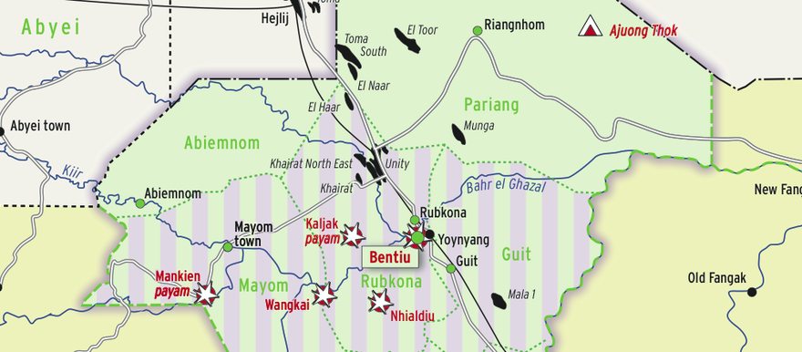
A new map shows areas of control in South Sudan’s Unity state by the SPLA-IO and the SPLA-Juba forces as of October 2014.
The map, created by the Switzerland-based Small Arms Survey and linked for download below, shows that SPLA-Juba forces allied with Salva Kiir control the northern counties of Pariang and Abiemnom, while the SPLA-IO forces allied with Riek Machar control Panyijar in the south.
Parts of Mayom, Rubkona, Guit, Koch, Mayendit, and Leer remain contested.
In a report accompanying the map, the Smalls Arms Survey explains: “The SPLA has retained control of Bentiu, as well as Abiemnom and Pariang counties, while the SPLA-IO dominates the southern counties of Panyijar, Mayendit, Leer, and Koch.”
Small Arms Survey says the SPLA-Juba forces generally occupy urban areas while SPLA-IO forces control the countryside.
The map shows that since May 2014 clashes have taken place in Nhialdiu, Wangkai, Bentiu, Kaljak Payam, and Mankien Payam.
To contact Radio Tamazuj with press releases, comments or information, write to radiotamazuj@gmail.com with full name and contact information.


