


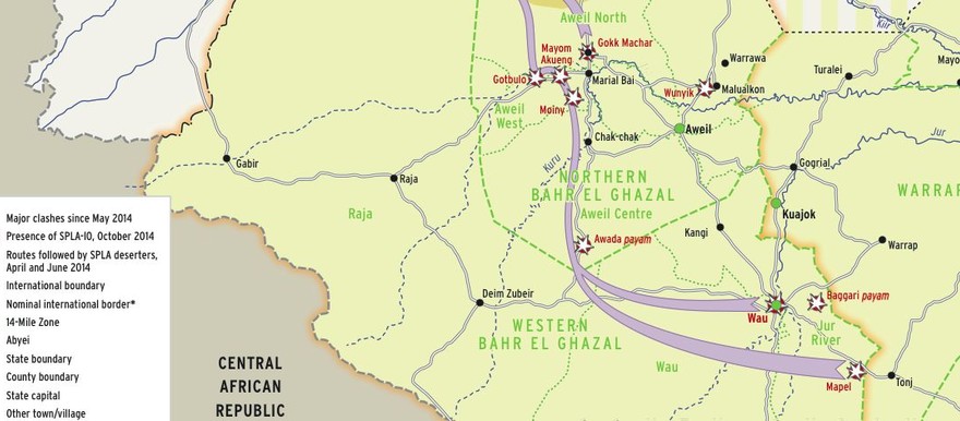
A new map shows areas of conflict in the Bahr el Ghazal region during the South Sudan civil war.
The map, released by Switzerland-based research group Small Arms Survey and linked for download below, shows that clashes have taken place in Wau, Baggari, and Mapel in Western Bahr el Ghazal state.
In Northern Bahr el Ghazal state there was fighting in Moini, Gotbulo, Mayom Akueng, Gokk Machar, Awada Payam, and Malual Kuon. There have also been clashes in Warguit on the Northern Bahr el Ghazal border with East Darfur in Sudan.
The map shows that much of the clashes took place along escape routes used by soldiers fleeing to Sudan after defecting from the SPLA-Juba loyal to President Salva Kiir.
A report accompanying the map explains that many of the defecting soldiers are ethnic Nuer soldiers fleeing racial violence, particularly from Mapel. Some defecting soldiers from Bahr el Ghazal may also be loyal to prominent renegade Dinka general Dau Aturjong. Others left their posts because they did not receive their salaries.

 and then