


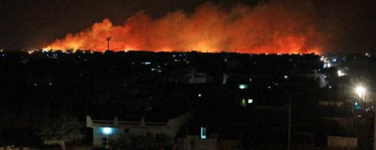
Khartoum’s accusations that Israeli fighter jets last week struck an arms factory gained some credence yesterday when satellite images were released showing large craters consistent with air bombardment. The images were released by Satellite Sentinel Project, which belongs to an US-based advocacy group that is normally critical of the Government of Sudan. The latest press release from the group is presented below unredacted. For their part, Israeli officials have declined comment to numerous press agencies.
Satellite Imagery of Explosions at Sudan Arms Plant ‘Consistent with Craters Created by Air-Delivered Munitions’
October 27, 2012
WASHINGTON – The Satellite Sentinel Project, or SSP, has released a comparative analysis of before-and-after DigitalGlobe imagery of the arms factory in the Khartoum, Sudan, which exploded and caught fire at approximately 12:30 a.m. on October 24.
SSP states that the imagery shows six large craters, each approximately 16 meters across and consistent with impact craters created by air-delivered munitions, centered in a location where, until recently, some 40 shipping containers had been stacked.
An October 12 image shows the storage containers stacked next to a 60-meter-long shed. While SSP cannot confirm that the containers remained on the site on October 24, analysis of the imagery is consistent with the presence of highly volatile cargo in the epicenter of the explosions.
Within 20 minutes of the conflagration, SSP communicated with eyewitnesses on the ground, who reported seeing flames, smoke, and “many explosions” in the Al Shagara neighborhood of southern Khartoum in the vicinity of an oil storage facility, a military depot, and an ammunitions plant. SSP received reports that the sky was “red from fireballs,” and that three fighter jets were “flying fast around southern Khartoum, to the northwest and northeast,” as a fourth, larger plane flew to the northeast at a much higher altitude.
SSP’s comparative analysis of DigitalGlobe imagery acquired on October 12, 2012 and on October 25 confirms the presence of an ammunitions plant at the Yarmouk Base, located approximately 11 kilometers southwest of the Khartoum International Airport, and confirms that large explosions took place within the base.
SSP’s report states:
“The explosions destroyed two buildings and heavily damaged at least 21 others, all within 700 meters of the epicenter. Visible damage includes roof panels blown off and scattered around the area, windows blown out, and walls knocked down. Nothing remains of the 60-meter building, which appears to have been pulverized in the blast.
“Fields adjacent to the military depot appear to be burned, but there is no indication of fire damage at the nearby Central Gas and Oil Company depot.
“At least six impact craters, each approximately 16 meters wide, are visible near the epicenter of the explosions and are consistent with craters created by air-delivered munitions. If the explosions resulted from a rocket or missile attack against material stored in the shipping containers, then it was an effective surgical strike that totally destroyed any container that may have remained and the adjacent 60-meter-long, shed-style building.”
Read the SSP Sitrep, “Explosions in Khartoum”: http://satsentinel.org/report/sitrep-explosions-khartoum-0
View or download the DigitalGlobe satellite imagery on Flickr: http://www.flickr.com/photos/enoughproject/sets/72157631860293132/with/8…
About the Satellite Sentinel Project
The Satellite Sentinel Project, or SSP, a partnership between the Enough Project and DigitalGlobe, conducts monitoring of the border between Sudan and South Sudan to assess the human security situation, identify potential threats to civilians, and detect, deter and document war crimes and crimes against humanity. The Enough Project provides field research, policy context, and communications strategy. DigitalGlobe provides imagery from its constellation of satellites and geospatial analysis from the DigitalGlobe Analysis Center. SSP is funded primarily by Not On Our Watch.
Photo by DigitalGlobe